
The State of California has released updated Fire Hazard Severity Zone (FHSZ) maps, which identify wildfire hazard areas within both State Responsibility Areas (SRAs), such as China Camp, and Local Responsibility Areas (LRAs). As required by State law, the City of San Rafael must adopt these maps. Before doing so, we invite public comment on the maps and their potential implications.
Key Information
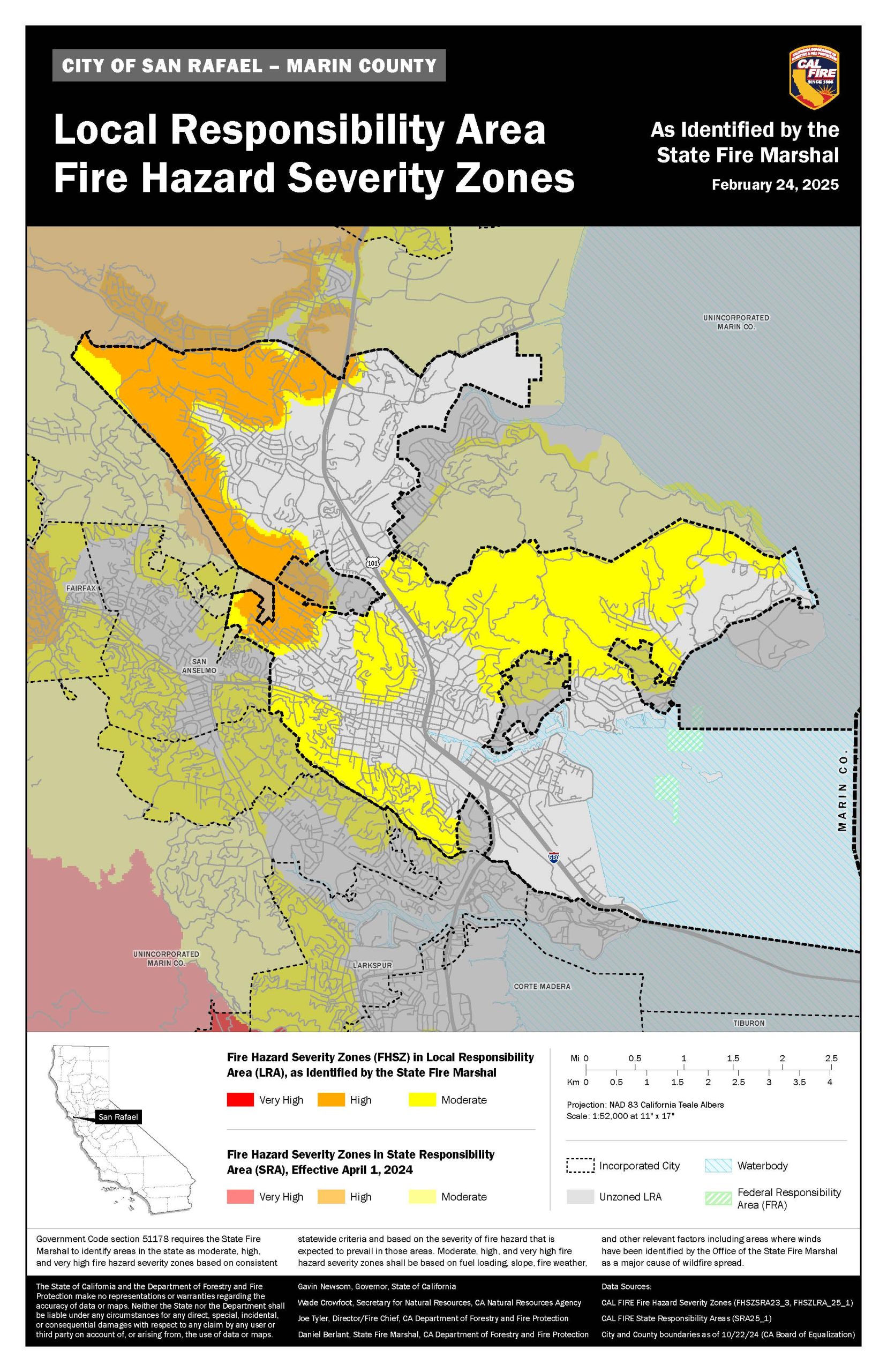
- View the Updated Maps: Fire Hazard Severity Zone Maps
- Public Comment Deadline: Submit comments by April 7, 2025, at 9:00 AM
- How to Submit Comments:
- Email: srfd.dspace@cityofsanrafael.org
- Form: Public Comment Form
- Mail:
San Rafael Fire Department
ATTN: FHSZ Comment Period
1375 Fifth Ave
San Rafael, CA 94901
Impact on San Rafael
The City does not anticipate significant or immediate changes for residents or City projects based on these updated maps. This is due to three key reasons:
- Alignment with Existing Wildland Urban Interface (WUI) – The maps largely mirror the City’s current WUI boundaries, which already enforce specific building code requirements.
- Citywide Vegetation Standards – San Rafael enforces vegetation management standards citywide to reduce wildfire risk for all properties.
- Ongoing Fire Risk Reduction Work – City staff are actively prioritizing wildfire mitigation efforts in high-risk areas and collaborating with partners like County Parks to manage risks strategically.
Background
The State’s mapping process is guided by legislation aimed at improving wildfire preparedness and hazard assessment:
- AB 337 (Bates Bill, 1992) – Enacted following the Oakland Hills Fire, this law requires CAL FIRE to evaluate fire hazards in LRAs and provide recommendations to local jurisdictions.
- SB 63 (Stern, 2021) – Expands FHSZ map adoption requirements to include all three hazard levels (Moderate, High, and Very High) in LRAs, aligning them with State Responsibility Area classifications.
How Fire Hazard Severity Zones Are Determined
The updated maps are based on a science-driven and field-tested model that evaluates multiple factors influencing fire likelihood and behavior, including:
- Fire history
- Vegetation (fuel sources)
- Predicted flame length
- Blowing embers
- Terrain
- Typical fire weather conditions
There are three hazard levels designated for State Responsibility Areas:
- Moderate
- High
- Very High
Understanding Hazard vs. Risk
It’s important to distinguish between hazard and risk:
- Hazard: The natural likelihood of an area experiencing a wildfire based on long-term factors (30-50 years). This does not consider mitigation efforts like fuel reduction or home hardening.
- Risk: The actual potential damage a fire could cause under current conditions, considering existing preventive measures like defensible space and fire-resistant building materials.
Provide Your Input
The City of San Rafael welcomes public feedback on the updated Fire Hazard Severity Zone maps before their adoption. Please share your thoughts by April 7, 2025, at 9:00 AM using one of the following methods:
- Email: srfd.dspace@cityofsanrafael.org
- Form: Public Comment Form
- Mail:
San Rafael Fire Department
ATTN: FHSZ Comment Period
1375 Fifth Ave
San Rafael, CA 94901
For additional details, you can review the State’s FAQ on the FHSZ maps here.
Your input helps ensure that wildfire preparedness efforts in San Rafael align with community needs. Thank you for your participation!